
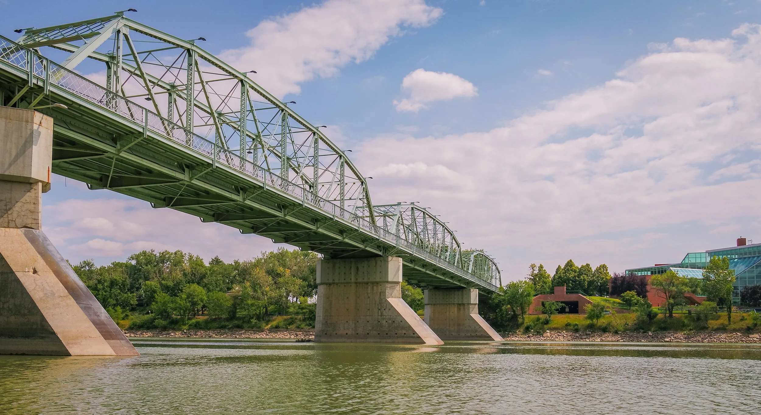
High resolution data collection for structural engineers to analyze bridge and structure integrity. This includes flying in GPS denied spaces.
High Resolution Image Collection
-
UAV pilot selects the grid area
Select the area of interest.
-

UAS collects images
The UAS is programmed to collect a series of high resolution images of the capture area.
-
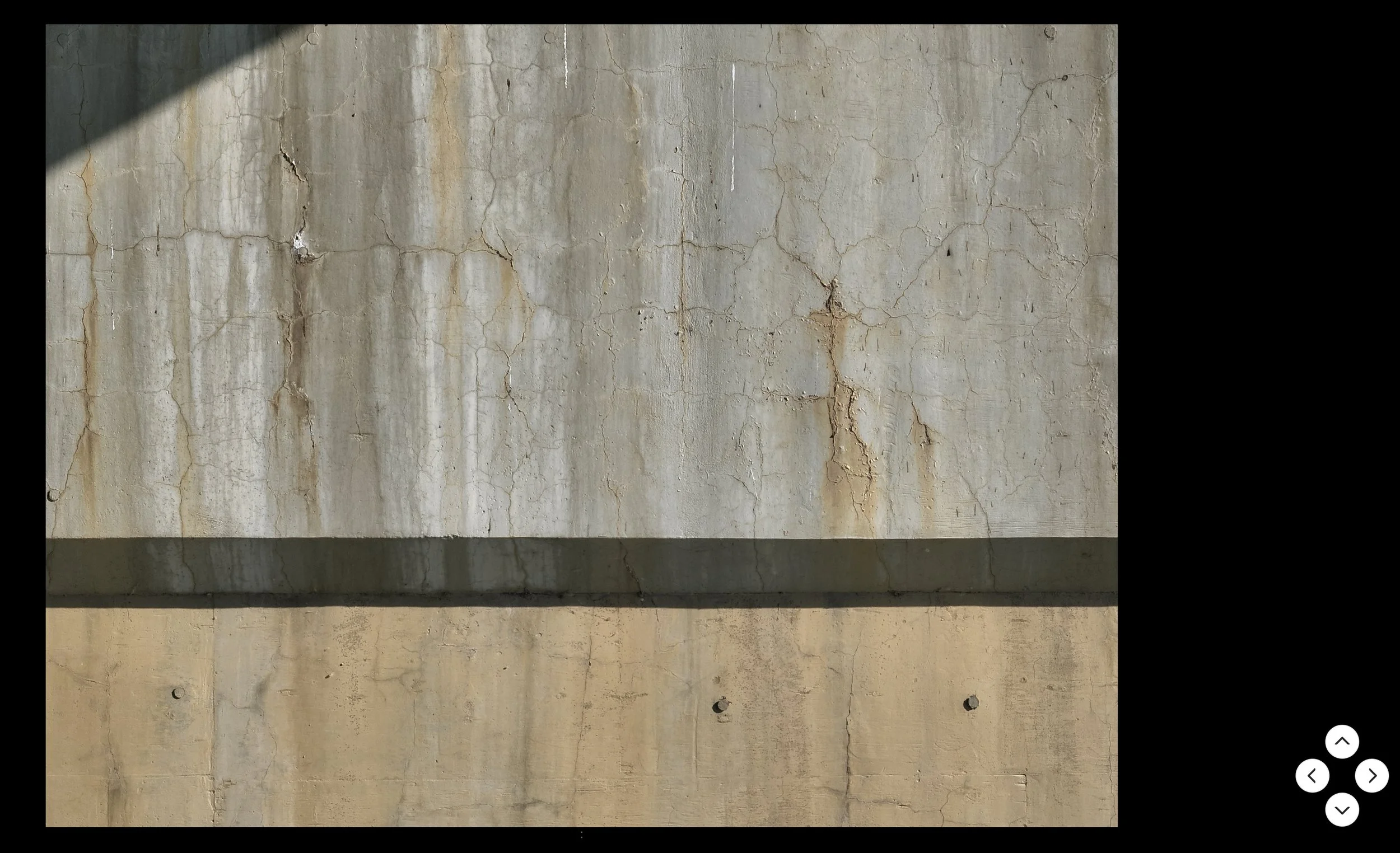
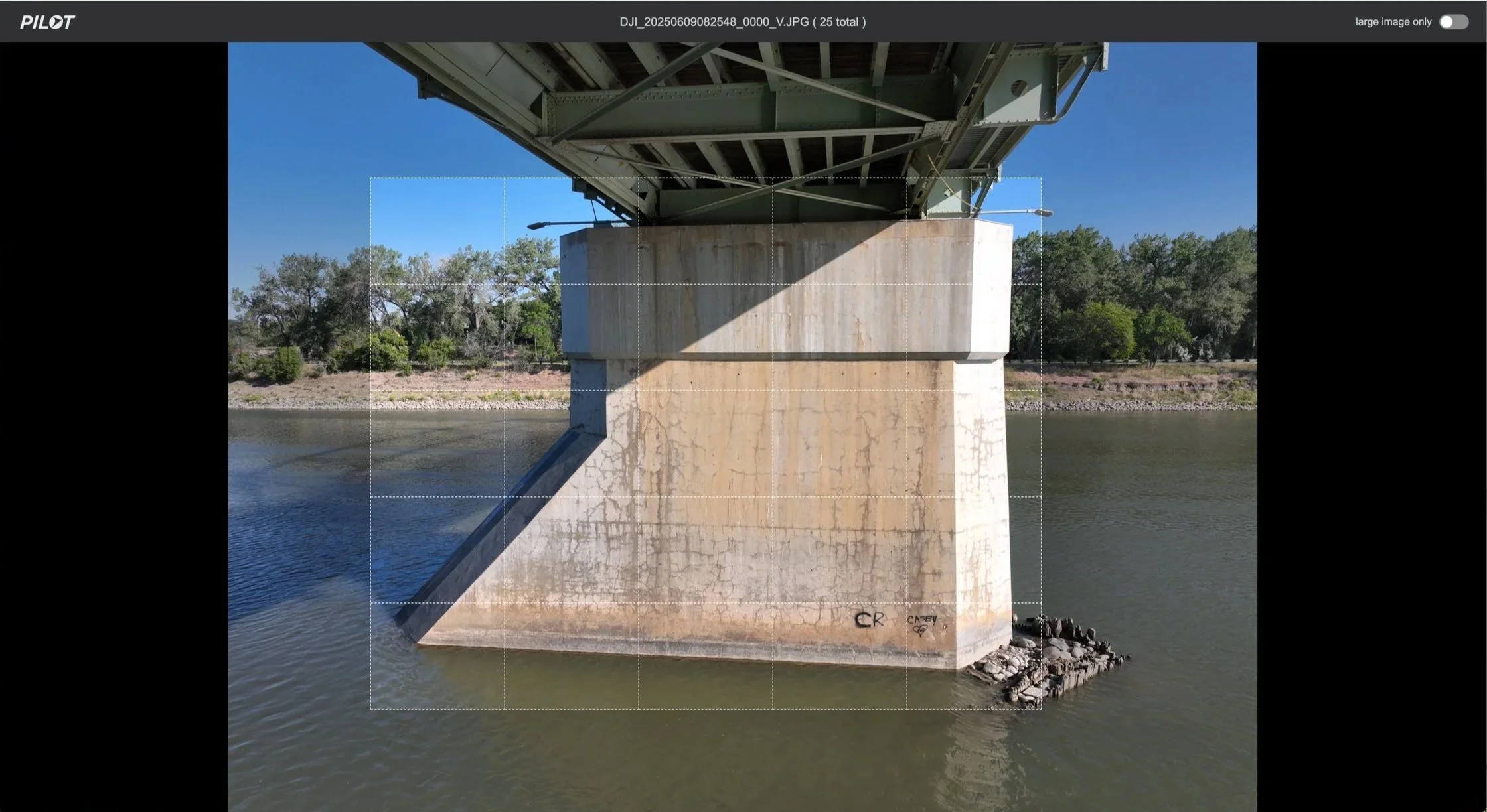
Client reviews the images
Client selects a block in the grid to review in high resolution.
-

Confined spaces
SkyReel operates with various aerial platforms, some designed to fly in confined and GPS denied spaces.
-

GPS denied spaces
Collecting images in previously GPS denied spaces (heavy steel and concrete) is now possible with specific aircraft in SkyReel’s fleet.
-

Structural changes over time
Engineers and project managers hire SkyReel to capture benchmark structural integrity images of an asset, and follow up on an annual or bi-annual basis to monitor continued changes and plan maintenance and repair strategies.